Highlands and F-roads: what you need to know
- 16 sources cited
- Last verified 2026-10-25
- Published 2026-10-25
Ad This page contains advertising boxes labelled "Ad"; if partner links are active we may earn a commission, at no extra cost to you. Affiliate disclosure
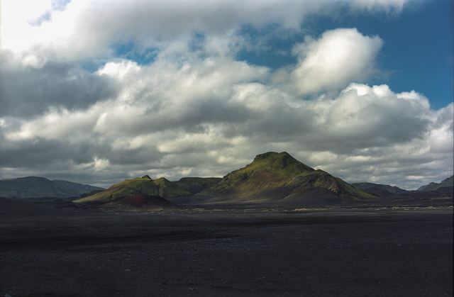
The highlands are Iceland's interior: Vegagerðin, the Road and Coastal Administration, classes land more than 300 m above sea level as highland, often snow-covered well into summer [1]. Most highland routes are F-roads, rough tracks that open only for a short summer window. Here is what the official sources say about when they open, which cars they suit, river crossings and the checks to make before you go.
Status now: closed for winter (checked 25 October 2026)
Safetravel says F-roads are usually closed from mid-September until June or July; in that period they are closed or impassable for anyone not in a modified vehicle (superjeep), and the way to get there is to book one with an experienced driver [2]. Vegagerðin's own road-condition data, exported at 02:06 Iceland time (UTC) on 25 October 2026, showed this for the main highland routes [3]:
| Route | Status in Vegagerðin's data, 25 Oct 2026 |
|---|---|
| F208 Fjallabaksleið nyrðri (incl. Sigalda–Landmannalaugar) | Impassable / not serviced |
| F225 Landmannaleið | Impassable / not serviced |
| F210 Fjallabaksleið syðri | Impassable (one section listed as impassable due to thaw mud) |
| F261 Emstruleið | Impassable / not serviced |
| F206 Lakagígar road | Impassable / not serviced |
| F26 Sprengisandur | Impassable |
| 35 Kjölur: Gullfoss–Kerlingarfjöll | Not serviced, condition not known |
| 35 Kjölur: Kerlingarfjöll–Blönduvirkjun | Impassable (snow) |
| F752 Skagafjarðarleið | Not serviced, condition not known |
| F821 Eyjafjarðarleið | Impassable |
| Öskjuleið (route to Askja) | Impassable / not serviced |
This is a snapshot, not a forecast. Status changes, and this page is not updated live: check umferdin.is (www.road.is redirects there) or call Vegagerðin's traffic service on 1777, open 24 hours [4] [1]. Road numbers in the table follow Vegagerðin's opening table [1].
F-road grades: F1, F2, F3
Vegagerðin grades highland tracks (landsvegir) in three types. All are tracks about 4 m wide, often lower than the land on either side, and often closed in winter because of snow and thaw mud [5]:
| Grade | What Vegagerðin says |
|---|---|
| F1 | Slow road, passable by general traffic in summer; large streams and rivers are bridged |
| F2 | Poor road, passable by 4x4s, very powerful cars and small SUVs; streams and small rivers unbridged |
| F3 | Rough road, only for large, well-equipped 4x4s (superjeeps); can be uneven, rocky and wet |
Safetravel adds that not every 4x4 suits every F-road: some suit a Dacia Duster or similar, others need a Toyota Land Cruiser or bigger, and some need a modified superjeep [2]. Rental terms also matter: one rental company's terms, for example, exclude F-roads unless the car is approved for them [6]. Read your contract and see our car rental guide.

When do the highland roads open?
Snow cover is the most important factor. Where a mountain road passes through a conservation area, it may stay closed until the whole area can withstand visitors, even if the road itself is clear [1]. In spring and early summer, while snow melts and the ground thaws, roads and vegetation are easily damaged, and the highland summer, the growing season for its sensitive vegetation, lasts only a month and a half [1].
Vegagerðin's opening dates, 2021–2025 [1]:
| Road | Average 2021–2025 | Earliest | Latest |
|---|---|---|---|
| 35 Kjölur: Gullfoss–Hveravellir | 1 Jun | 30 May | 14 Jun |
| F208 Sigalda–Landmannalaugar | 2 Jun | 23 May | 23 Jun |
| 35 Kjölur: Hveravellir–Blönduvirkjun | 6 Jun | 1 Jun | 14 Jun |
| F225 Landmannaleið (Dómadalur) | 16 Jun | 9 Jun | 24 Jun |
| F206 Lakagígar | 20 Jun | 12 Jun | 1 Jul |
| F208 Landmannalaugar–Eldgjá | 25 Jun | 16 Jun | 6 Jul |
| F210 Hvanngil–Skaftártunga | 29 Jun | 23 Jun | 6 Jul |
| F752 Skagafjarðarleið | 4 Jul | 21 Jun | 13 Jul |
| F261 Emstruleið | 5 Jul | 23 Jun | 15 Jul |
| F26 Sprengisandur | 6 Jul | 21 Jun | 13 Jul |
| F210 Keldur–Hvanngil | 7 Jul | 23 Jun | 15 Jul |
| F821 Eyjafjarðarleið | 7 Jul | 23 Jun | 15 Jul |
We leave out the F208 Eldgjá–Skaftártunga row: its published average (13 May) is earlier than every yearly date in the same row, so it looks like a typo [1]. Past dates do not predict next year's opening; we do not guess dates.
In spring and early summer, Vegagerðin and the Environmental and Food Agency publish maps showing where traffic on mountain tracks is banned because of thaw; all traffic in the shaded areas is prohibited until further notice [1] [7]. When we checked on 25 October 2026, the latest map for 2026 was no. 16, valid from 30 July 2026 [7]. The map only covers thaw closures, not snow or general road conditions, so check umferdin.is as well [7].
River crossings and insurance
Safetravel states that no insurance covers damage to a vehicle while crossing a river: the risk is always yours, and damage can cost thousands of euros or dollars [2]. Its advice [2]:
- Current and depth change constantly, and rivers often become impassable.
- If unsure, do not cross: turn around, or wait for other travellers.
- Plan your line first, drive very slowly in the lowest gear (low range), steadily, and do not change gear in the water.
- Angle downstream rather than against the current, and watch for big rocks under the surface.
The "unbridged rivers" road sign is most common on F-roads; Safetravel says such crossings are only suitable for bigger 4x4s [8]. More on what rental insurance typically excludes: car rental insurance.
Rules on and off the track
- Driving on F-roads and gravel roads is not off-road driving; leaving them is [9] [10].
- Off-road driving is illegal and punishable by fines or imprisonment [11]. Drive slowly over obstacles on the track instead of going around them [11].
- Vegagerðin warns that the greatest spring damage comes from vehicles leaving the road to get around snowdrifts [1].
- "Lokað" means closed. A closed road is closed to all vehicles, including bicycles and motorcycles [8] [10].
- Speed limits apply only in the best conditions; choose your speed for the road and weather [10].
- Google Maps and other map apps may not show closed or impassable roads [12].
Before a highland day
- Is the road open? Check umferdin.is or call 1777 [4] [5]. Safetravel says this is the first thing to check [2].
- Weather Forecasts and weather warnings from the Icelandic Met Office on vedur.is [13]; check conditions in the morning and again during the day [10].
- Alerts Current alerts on safetravel.is [14]. Ask locally too: Safetravel suggests information centres, rangers and hut wardens [2].
- Travel plan Leave one on safetravel.is with someone not on the trip who can react if you do not check in [15].
- Car and contract Is your 4x4 suitable for this grade of road, and does your rental contract allow it [5] [6]?
Emergency: 112
Call 112 in any emergency, 24 hours a day. You can also use the 112 Iceland app or web chat; if calling 112 fails, try +354 599 0112 [16]. Report off-road driving you witness to the police on 112 or to rangers [11].
More planning
- Car rental, 4x4s and F-roads
- Safety and road conditions
- Ring Road guide (no F-roads needed)
- Seasons month by month
- 5, 7 and 10-day itineraries
FAQ
Are the F-roads open now (late October)?
No, not in the normal sense. Safetravel says F-roads are usually closed from mid-September until June or July. On 25 October 2026 Vegagerðin's road-condition feed listed the main highland routes, including F208, F225, F210, F26, F206, F261 and F821, as impassable or not serviced, and Kjölur (road 35) as impassable between Kerlingarfjöll and Blönduvirkjun. Check umferdin.is for today's status. [2] [3]
When do the F-roads open?
There is no fixed date: snow cover decides. Vegagerðin's 2021–2025 averages range from 1 June (Kjölur, Gullfoss–Hveravellir) and 2 June (F208 Sigalda–Landmannalaugar) to 7 July (F210 Keldur–Hvanngil, F821). Past dates do not guarantee next year's opening. [1]
Does insurance cover river crossings?
Safetravel states that no insurance covers damage to a vehicle while crossing a river; the risk is always yours. [2]
Sources
- Opening of mountain roads
Vegagerðin · accessed 2026-10-25 - Highland driving
Safetravel / ICE-SAR · accessed 2026-10-25 - Road conditions open-data feed (færð), incl. highland flag (ErHalendi)
Vegagerðin (Icelandic Road and Coastal Administration) · in Icelandic · accessed 2026-10-25 · via curl (JSON); raw copy in research/raw/vegagerdin-faerd2014_1-2026-10-25.json and faerd2017_1 (English labels) - Umferdin.is: road conditions map (road.is redirects here)
Vegagerðin · accessed 2026-10-25 - Vegir (roads): road categories, Ring Road length, F-road types
Vegagerðin (Icelandic Road and Coastal Administration) · in Icelandic · accessed 2026-10-25 - What is not covered by insurance?
Geysir Car Rental · tour operator (commercial claim) · accessed 2026-10-24 - Hálendiskort (highland thaw-closure map)
Vegagerðin · in Icelandic · accessed 2026-10-25 · via direct fetch + curl of PDF /media/2024/06/kort-16_2026.pdf, pdftotext - Road signs
Safetravel / ICE-SAR · accessed 2026-10-25 - How to drive in Iceland (winter leaflet, 2023)
Icelandic Transport Authority (Samgöngustofa) · accessed 2026-10-25 · via curl + pdftotext - Top 12 tips
Safetravel / ICE-SAR · accessed 2026-10-25 - Off-road driving leaflet
Environment Agency of Iceland (Umhverfisstofnun) · accessed 2026-10-25 · via curl + pdftotext - Driving in Iceland
Safetravel / ICE-SAR with the Icelandic Transport Authority · accessed 2026-10-25 - Icelandic Met Office (Veðurstofa Íslands), English site
Icelandic Met Office (IMO) · accessed 2026-10-24 - Travel conditions (alerts)
Safetravel / ICE-SAR · accessed 2026-10-25 - Travel plans
Safetravel / ICE-SAR · accessed 2026-10-25 - 112 – When in need of assistance
Neyðarlínan (112 Iceland) · accessed 2026-10-25