The South Coast: Seljalandsfoss to Jökulsárlón
- 13 sources cited
- Last verified 2026-10-24
- Published 2026-10-24
Ad This page contains advertising boxes labelled "Ad"; if partner links are active we may earn a commission, at no extra cost to you. Affiliate disclosure
The South Coast runs along Route 1 with waterfalls, black-sand beaches and glacier lagoons on or near the Ring Road. Visit Iceland puts it at approx. 480 km from Þorlákshöfn to Höfn and suggests 1 to 7 days [1].
At a glance
| What the sources say | |
|---|---|
| Distance | Approx. 480 km from Þorlákshöfn to Höfn [1] |
| Time | 1 to 7 days [1] |
| Season | All year; summer is best for hiking; 4x4 not required [1] |
| Fees | Regional parking fee at Skaftafell and Jökulsárlón [2] |
| Beds | Book Selfoss–Höfn well ahead in summer [3] |
The main stops, west to east
Seljalandsfoss and Gljúfrabúi
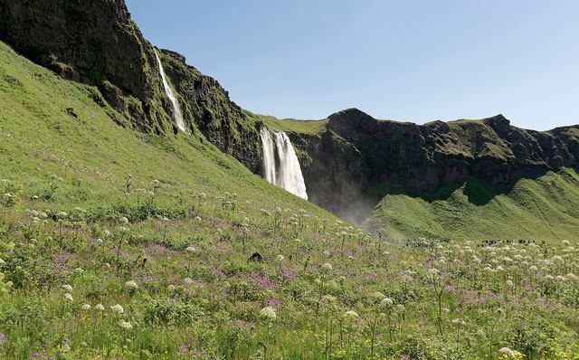

Seljalandsfoss, which you can walk behind, and the half-hidden Gljúfrabúi are close to the Ring Road [1]. The path behind the falls is wet and slippery; bring a waterproof layer.
Skógafoss
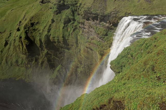
Also next to the Ring Road [1]. Note that the Environment Agency lists Skógafoss among places where overnight stays are banned or restricted outside designated areas [4].
Vík and Reynisfjara
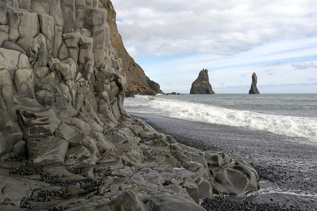

Reynisfjara is the most dangerous stop on this route. Safetravel warns of sneaker waves that reach far up the beach without warning and of falling rocks from the cliffs, and states that lives have been lost there [5].
A warning-light system is in place [5]:
- Yellow: moderate danger. Stay well back from the water and never turn your back on the sea.
- Orange: considerable danger. Stay at least 25 m (82 ft) from the sea.
- Red: the beach is closed; use the viewing area.
Keep children with you at all times [5]. Access arrangements can change at short notice, so check Safetravel's black beach page on the day.
Dyrhólaey, west of Vík, is listed as a place where overnight stays are not allowed [4].
Skaftafell
Part of Vatnajökull National Park, with hiking trails and a campsite. Visit Iceland describes Vatnajökull as Europe's largest glacier [1].
Jökulsárlón and Fjallsárlón
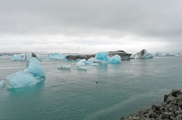

Icebergs calve from the glacier into these lagoons; boat tours operate on both [1]. Höfn lies further east, and from 24 June 2026 a new, 12 km shorter section of Route 1 runs through Hornafjörður [6].
Parking fees in Vatnajökull National Park
Regional fee for Skaftafell and Jökulsárlón, as published by the park (checked 24 October 2026) [2]:
| Vehicle | Fee |
|---|---|
| Car, 5 seats or fewer | ISK 1,110 |
| Vehicle with 6 to 9 seats | ISK 1,440 |
| Motorcycle | ISK 450 |
The fee is valid until midnight on the day of payment, and a second fee-based area visited the same day is charged at 50% [2]. Number-plate cameras register vehicles; pay in the Parka app or at the machines [2].
Planning tips
- Distances look short on a map, but stops add up: Visit Iceland's rule is to add an hour to every driving estimate [7].
- In summer, book beds along this stretch early [3]. See Where to stay.
- Sleeping in a campervan or car outside a campsite needs the landowner's permission [4]. Use campsites.
- Glacier walks and ice caves are guided activities only; never walk onto a glacier without a qualified guide. Our sister site covers ice caves by month (coming soon).
Put it together: 5-day and 7-day itineraries, or continue around the Ring Road.
FAQ
How long is the South Coast route?
Visit Iceland describes it as approximately 480 km from Þorlákshöfn to Höfn, and suggests anything from 1 to 7 days. [1]
Is Reynisfjara dangerous?
Yes. Safetravel warns of sneaker waves and falling rocks, says lives have been lost, and runs a warning-light system: at orange, stay at least 25 m from the sea; at red, the beach is closed. [5]
How much is parking at Jökulsárlón and Skaftafell?
Vatnajökull National Park charges a regional fee of ISK 1,110 for a car with up to 5 seats, valid until midnight, with 50% off a second fee area on the same day (checked 24 October 2026). [2]
Sources
- The South coast
Visit Iceland · accessed 2026-10-24 - Pricelist
Vatnajökull National Park · accessed 2026-10-24 - The Ring Road – Route Number One
Visit Iceland · accessed 2026-10-24 - Where can you camp?
Environment Agency of Iceland (Umhverfisstofnun) · accessed 2026-10-24 - Black Beach Safety (Reynisfjara)
Safetravel / ICE-SAR · accessed 2026-10-24 - Nýr Hringvegur (1) um Hornafjörð opnaður 24. júní
Vegagerðin · in Icelandic · accessed 2026-10-24 - 5 golden rules for planning a trip to Iceland
Visit Iceland · accessed 2026-10-24 - Umferdin.is: road conditions map (road.is redirects here)
Vegagerðin · accessed 2026-10-24 - Opening of mountain roads
Vegagerðin · accessed 2026-10-24 - Icelandic Met Office (Veðurstofa Íslands), English site
Icelandic Met Office (IMO) · accessed 2026-10-24 - Travel conditions (alerts)
Safetravel / ICE-SAR · accessed 2026-10-24 - Travel plans
Safetravel / ICE-SAR · accessed 2026-10-24 - 112 – When in need of assistance
Neyðarlínan (112 Iceland) · accessed 2026-10-24